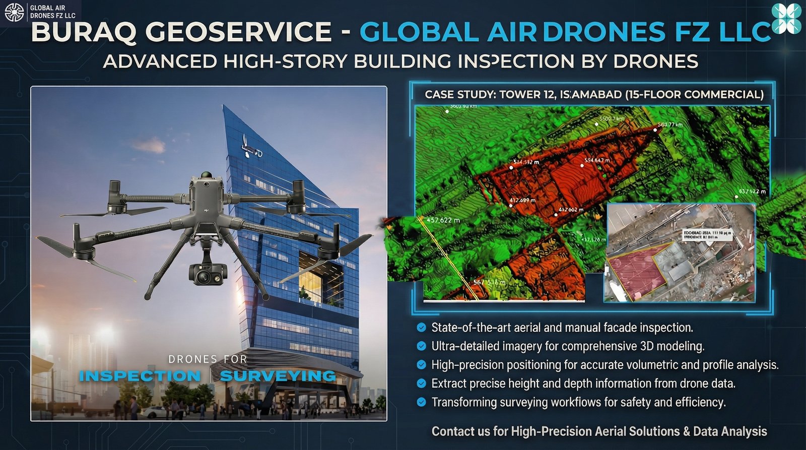
Smart Building Surveys – Tower 12, Islamabad
Rapid deployment for high-story commercial assets using 3D modeling and aerial surveying to extract actionable height, depth, and volumetric data instantly.
The Challenge
Why spend weeks on scaffolding when you can map a 15-story tower in hours? Traditional building survey methods are time-consuming, costly, and often inefficient for high-rise commercial assets. The challenge was clear: deliver rapid, precise, and data-rich surveying solutions that eliminate the need for manual measurements and reduce project timelines.
Measurable Impact
Speed
Rapid deployment for high-story commercial assets, completing surveys in hours instead of weeks, significantly reducing project timelines.
Precision
High-precision positioning and 3D modeling delivering accurate height, depth, and volumetric data for engineering applications.
Data-Rich Insights
Extract actionable data instantly, enabling informed decision-making and eliminating manual measurement errors.
The Solution & Outcome
Buraq GeoServices delivers speed through rapid deployment for high-story commercial assets, precision through high-precision positioning for accurate 3D modeling, and data-rich insights through comprehensive aerial surveying. The Tower 12 project demonstrated that 3D modeling and aerial surveying aren't just technology—they are essential tools for cost-saving maintenance and efficient project delivery.
By choosing Buraq Geoservice, clients eliminate weeks of traditional scaffolding work, extract actionable height, depth, and volumetric data instantly, and gain data-rich insights that support precise engineering and planning decisions. This approach transforms building surveying from a time-consuming manual process into a rapid, accurate, and data-driven operation.
Key Technologies Used
- Advanced 3D modeling software for precise structural analysis
- High-precision aerial surveying equipment for accurate data capture
- Instant data extraction for height, depth, and volumetric analysis
- Digital integration with engineering and maintenance systems