Preparation of the Action Plan for the Implementation of NSDI in Kazakhstan
Asian Development Bank (ADB)
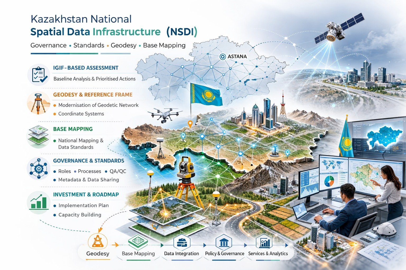
A National Spatial Data Infrastructure (NSDI) blueprint aligning governance, standards, and investment to enable interoperable geospatial services at scale.
The Challenge
Fragmented geospatial governance, uneven data quality, and limited interoperability between custodians made it difficult to operationalise national base mapping, modernise the geodetic reference frame, and establish integration-ready services across government.
Measurable Impact
3:1 Benefit-Cost Ratio
A discounted cash-flow Cost–Benefit Analysis (CBA) assessed Return of Investment (RoI) against the opportunity cost of capital. Using conservative benefits from ~15% of identified use cases, the estimated benefit–cost ratio is ~3:1.
IGIF-Based Governance
Applied an IGIF-based, governance-led NSDI delivery model, establishing a standards-aligned baseline and operational guidance for geodesy and coordinate systems.
Implementation-Ready Roadmap
Prioritised action and investment roadmap with implementation-ready specifications for roles, processes, QA/QC, metadata and service patterns.
The Solution & Outcome
Lade Agenda applied an IGIF-based, governance-led NSDI delivery model, establishing a standards-aligned baseline, a prioritised action and investment roadmap, and operational guidance for geodesy, coordinate systems, and the geodetic reference frame.
Implementation-ready specifications (roles, processes, QA/QC, metadata and service patterns) enabled stakeholders to execute consistently, strengthening base mapping, controlled data sharing, and scalable platform integration.
Key Deliverables
- Standards-Aligned Baseline: Established governance framework and technical standards for national geospatial infrastructure
- Geodetic Reference Frame: Operational guidance for modernising geodesy and coordinate systems
- Base Mapping Strategy: Specifications for national base mapping operationalisation
- Interoperability Framework: Service patterns and metadata standards for cross-agency integration
- Investment Roadmap: Prioritised action plan with cost-benefit analysis and implementation timeline
Project Highlights
Strategic Components
Governance & Policy
- • NSDI governance structure
- • Data custodian roles & responsibilities
- • Policy alignment framework
Technical Standards
- • Geodetic reference frame specifications
- • Metadata and service standards
- • QA/QC protocols
Base Mapping
- • National base mapping strategy
- • Data quality specifications
- • Production workflows
Platform Integration
- • Interoperability patterns
- • Service architecture
- • Scalable integration design