Redefining Hydrological Insights
Advanced UAV technology delivering high-density LiDAR mapping, 3D bathymetric modeling, and precision digital twins for water management and floodplain analysis.
The Challenge
Water is our most precious resource, yet rivers and floodplains are among the most difficult terrains to map. Traditional methods are slow, dangerous, and often lack the centimeter-level accuracy needed for critical decision-making. How do we protect communities and optimize irrigation without a perfect view of the landscape? The challenge was clear: deliver centimeter-level accuracy and actionable insights where traditional methods fail, eliminating the "zero-visibility" problem in water management.
Measurable Impact
Faster Operations
High-density LiDAR mapping penetrates dense vegetation and navigates inaccessible riverbanks, delivering data in hours instead of weeks.
Zero-Risk Operations
Centimeter-level accuracy eliminates guesswork and enables confident decision-making for critical infrastructure projects.
Actionable Data
Real-time hydrological insights empower engineers, policymakers, and communities with precise floodplain analysis and water flow predictions.
The Solution & Outcome
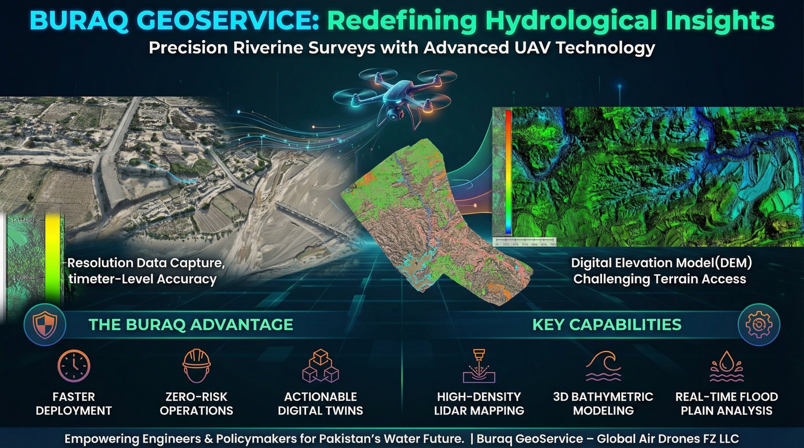
At Buraq GeoService, we bridge the gap between complex terrain and actionable data using advanced UAV technology. Our drones penetrate dense vegetation and navigate inaccessible riverbanks to deliver what human eye and ground teams cannot. We provide high-density LiDAR mapping that slices through canopy to reveal the true ground surface, 3D bathymetric modeling to map underwater topography and understand river volume and flow, and precision digital twins creating a 1:1 virtual replica of the environment for simulation.
We aren't just delivering maps; we are delivering foresight. Our technology provides real-time data to engineers for designing resilient infrastructure, accurate flood-plain analysis to policymakers for protecting lives and livelihoods, and actionable intelligence for building a data-driven foundation for water management in the region. From riverbeds to floodplains, we provide intelligence for Pakistan's water future.
Key Technologies Used
- High-Density LiDAR mapping for centimeter-level terrain accuracy
- 3D bathymetric modeling for underwater topography and river analysis
- Precision digital twins for simulation and planning
- Advanced hydrological analysis for water flow and floodplain management