Emergency Response: When Every Second Matters
Emergency flood response operations providing live aerial surveillance and thermal imaging to locate stranded survivors and guide rescue teams during critical flood disasters.
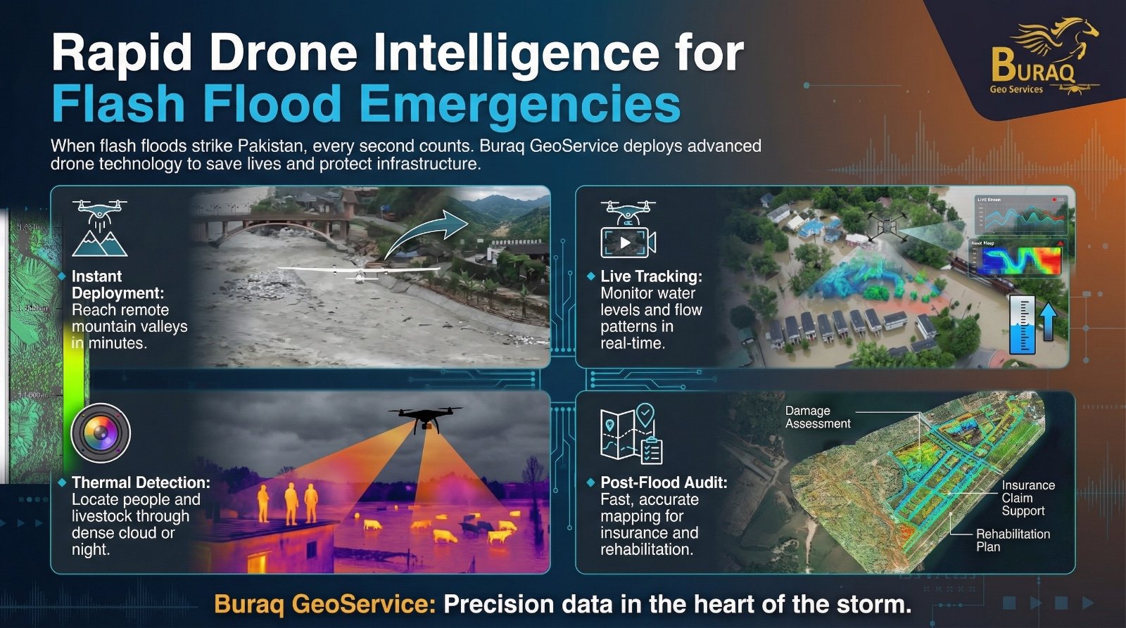
The Challenge
When torrential rains swelled mountain rivers beyond their limits, villages once safe along valleys found themselves surrounded by rising water. Roads disappeared, communication lines went silent, and chaos turned into crisis. In those critical moments, when every second became the difference between safety and disaster, traditional response teams struggled to reach remote, inaccessible regions. The challenge was clear: deliver clarity when uncertainty threatened lives, and provide actionable intelligence when visibility was lost.
Measurable Impact
Rapid Deployment
Within minutes of crisis onset, drones reached areas where traditional response teams couldn't access, providing immediate aerial coverage of disaster zones.
Real-Time Intelligence
Live streaming enabled emergency teams to monitor water levels, flow patterns, and identify safe evacuation routes as conditions evolved.
Life-Saving Detection
Advanced thermal imaging located stranded families and hidden survivors when visibility dropped, turning every detection into a rescue opportunity.
The Solution & Outcome
Buraq GeoServices & Global Air Drones took flight within minutes, deploying drones to remote, inaccessible regions where traditional response teams struggled to arrive. Flying above raging waters and broken terrain, they delivered something invaluable: clarity. Live feeds began streaming instantly, enabling emergency teams to watch in real time as water levels surged, flow patterns shifted, and safe evacuation routes emerged.
As night fell and visibility dropped, the mission continued with advanced thermal imaging detecting what the human eye could not—families stranded on rooftops, livestock trapped in flooded fields, survivors hidden beneath dense cloud cover. When waters receded, Buraq GeoServices transformed aerial data into high-precision maps, revealing the full extent of damage, identifying infrastructure weaknesses, affected zones, and recovery priorities with speed and accuracy that enabled faster insurance validation and smarter rehabilitation planning.
Key Technologies Used
- Rapid deployment drone systems for immediate aerial response
- Live streaming capabilities for real-time intelligence delivery
- Advanced thermal imaging for night operations and survivor detection
- High-precision mapping for damage assessment and recovery planning