Digital Geological Mapping & Resource Estimation – Gilgit Lead Mine
Detailed geological mapping of a 2 sq. km area, including digitization of geological maps and cross-sections for mineral reserve estimation.
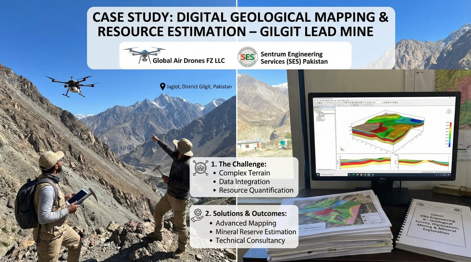
The Challenge
The Digital Geological Mapping & Resource Estimation – Gilgit Lead Mine project, executed by GAD's partners Sentrum Engineering Services (SES) Pakistan, faced three critical challenges: performing detailed geological mapping of a 2 sq. km area in the complex terrain of Jaglot, District Gilgit; converting traditional field observations into high-precision digital formats to support engineering-level decision-making for mining operations; and moving from surface mapping to a reliable estimation of mineral reserves to determine the commercial viability of the lead mine.
Measurable Impact
Operational Foundation
Provided the foundational data required for Elba Engineering to proceed with infrastructure and extraction planning at the site.
Precision in Exploration
The digitization process reduced the margin of error in geological interpretation, allowing for more accurate targeting of mineral veins.
Strategic Visualization
Through detailed terrain models and 3D geological cross-sections, the client gained comprehensive understanding of subsurface lithology before capital commitment.
The Solution & Outcome
SES utilized advanced field geological mapping and specialized software to create digitized geological maps and cross-sections of the challenging 2 sq. km area. By applying geoscientific analysis to the mapped data, the team provided precise estimations of mineral reserves, which are critical for mine design and long-term planning.
The project included comprehensive mine design consultancy, ensuring that the transition from exploration to extraction followed optimized engineering standards. This integrated approach enabled Elba Engineering to make informed decisions about infrastructure development and extraction operations based on reliable geological data.
Key Technologies Used
- Advanced field geological mapping techniques
- Specialized digitization software for geological maps and cross-sections
- Geoscientific analysis for mineral reserve estimation
- 3D terrain modeling and geological cross-section creation