From Degraded Land to Climate Assets
Large-scale VCS ARR project transforming floodplains into resilient, revenue-generating landscapes through afforestation, reforestation, and revegetation using drone photogrammetry and AI analytics.
The Challenge
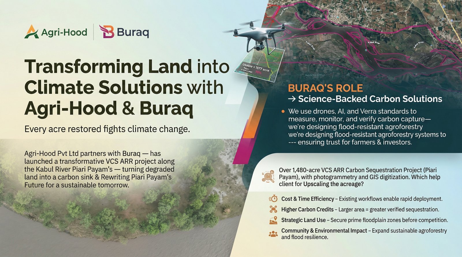
Along the banks of Kabul River, land once lost to floods, erosion, and neglect was being reimagined. What was once unproductive terrain needed transformation into a living carbon asset—restoring ecosystems, supporting communities, and fighting climate change at scale. The challenge was clear: turn vulnerable floodplains into resilient, revenue-generating landscapes through a partnership between Agri-Hood Pvt Ltd and Buraq GeoServices, backed by Verified Carbon Standard (VCS) methodology.
Measurable Impact
Ecosystem Restoration
Reviving degraded land into productive ecosystems through large-scale afforestation and reforestation initiatives.
Community Empowerment
Creating sustainable livelihoods for local communities while strengthening climate resilience in flood-prone regions.
Scalable Climate Solutions
Establishing a replicable model for climate investment that can be expanded rapidly and efficiently.
The Solution & Outcome
Through a large-scale VCS ARR (Afforestation, Reforestation, and Revegetation) project in Piari Payam, this partnership is not just planting trees—it is building a sustainable future backed by science and data. Above the fields, drones quietly map every acre, while below, data comes alive through Buraq's integration of drone photogrammetry, AI analytics, and GIS intelligence.
The project measures, monitors, and verifies carbon capture with precision, ensuring transparency and trust for investors, stakeholders, and farmers. Every tree, every hectare, and every carbon unit is tracked through advanced digital systems, ensuring that this is climate action—measured, verified, and scalable. The project is engineered for flood-resistant agroforestry systems, carefully designed to thrive in challenging environments by aligning land use with natural water flow patterns to reduce risk while maximizing ecological and economic returns.
Key Technologies Used
- Drone photogrammetry for precise land mapping and tree counting
- AI analytics for carbon sequestration calculation and verification
- GIS intelligence for land use optimization and flood resistance planning
- Digital monitoring systems for real-time carbon tracking
Project Highlights
Scaling Impact
"This is not just a project—it's a replicable model for climate investment. This is how land transforms. This is how climate solutions scale. This is how trust is built—through data, transparency, and impact."